
 SE Minnesota-Regional Weather View
Note: There have been changes to my regional map besides a slight shift south, I’ve also added cities, and my hometown Clayton is represented as a green ( * ) mark, and is shown out of respect and for my family.
A weather pattern that is sunny one day, then a chance at storms the next has set up across the Upper Midwest bringing a chance at storms every other day it seems, especially across the north. Thursday will still be sunny and warm with the influence of high pressure. Then Friday a chance at some storms will move across the Upper Midwest on Friday. It does not appear like these will be severe. It sunny skies move back in Saturday across the west, with still a chance of storms east.
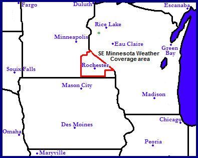
 Local View
Note: Welcome to my new local view of Southeastern Minnesota! This map was put together by me.
Locally we can expect a sunny an warm day Thursday without rain, there will be more sunshine early and clouds building in the evening. Highs will be on the warm side in the mid 80s across most locations with lows in the mid 60s. Friday is our next chance for rain, which some areas could use quite badly across our area. Besides the chance o showers and storms it will be sunny, but there will be more cloudiness around. The best chance at showers storms appears to be in the afternoon. It does not look likely that any of these will be severe, but a couple could bring heavy rainfall. Saturday, the cold front bringing Fridays storm chance will still be close enough to produce a random shower or storm early in the day, then we will have clearing skies and less humid conditions. Highs will be in the upper 70s to low 80s with lows in the low 60s.
 Metro View
For the Rochester Metropolitan area we can expect the same as above for sunshine Thursday and precip chances Friday and early Saturday, the only difference will be is it will be a bit warmer, Thursday highs could possibly reach upper 80s. Friday, The best chance of rain for Rochester will be in the afternoon and evening. Highs will be the low 80s and lows in the low 60s, and Saturday the best chance will be in the morning, then skies should clear in the afternoon with high in the upper 70s and lows near 60.
Thursday, Sunny Skies Warm with highs in the mid to upper 80s. Increasing cloudiness in the afternoon. Thursday Night, Partly Cloudy, lows in the low to mid 60s.
Friday, Partly Sunny and warm, with a chance of showers and thunderstorms in the afternoon. Highs in the low to mid 80s. Friday Night, A chance of thunderstorms, otherwise cloudy with lows in the low 60s.
Saturday, A small chance of showers and thunderstorms early, then clear skies. Highs in the mid to upper 70s. Saturday Night, Partly Cloudy with lows in the upper 50s to low 60s.
Looking Ahead
Sunday day should be dry, but Sunday Night looks more cloudy day with a chance of light showers, most of the heaviest rain looks to go North. Monday looks brighter and and cooler, then slowly rising temperatures with dry conditions much of the week between the dates of the 22nd through the 25th, it also looks increasingly hot towards the days approaching the 25th. Its not until a system moves in from the west on the 27th that we will have our next chance of rain, and it’s a quick shot of rain because then it looks cooler and drier again for the 27th through the 30th. The start of the September looks presently cooler and dry at this time.
Welcome to the other side of the St. Croix/Mississippi, Derek!
Ryan
thanks Ryan!