The Storm Prediction Center has issued a slight risk of severe weather for mainly later this evening into Wednesday night for areas in Iowa west of a line from Algona to Iowa Falls to Knoxville to Centerville. The main threat will be from large hail with some strong gusty winds being a secondary threat. Thunderstorms will likely develop over Nebraska and Kansas in the afternoon and move into the state this evening. Heavy rainfall will like accompany the storms as well. The risk of severe weather has been dropped for the entire state on Thursday, however an isolated thunderstorm may still be possible with some small hail across the state along with more heavy rain.

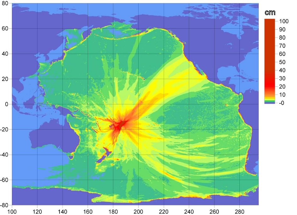
This map above shows the propagation of the Tsunami that was generated earlier from an 8.0 earthquake that occurred over American Samoa in the early afternoon hours (Iowa Time) Tuesday. The largest waves (over 5 feet) stayed within 500-1000 miles of the earthquake, with smaller waves (roughly 1-2 feet) reaching the western coasts of North and South America a few hours ago.